South Texas Stories – Corpus Christ, All-American City


A DEL MAR COLLEGE STUDENT PUBLICATION

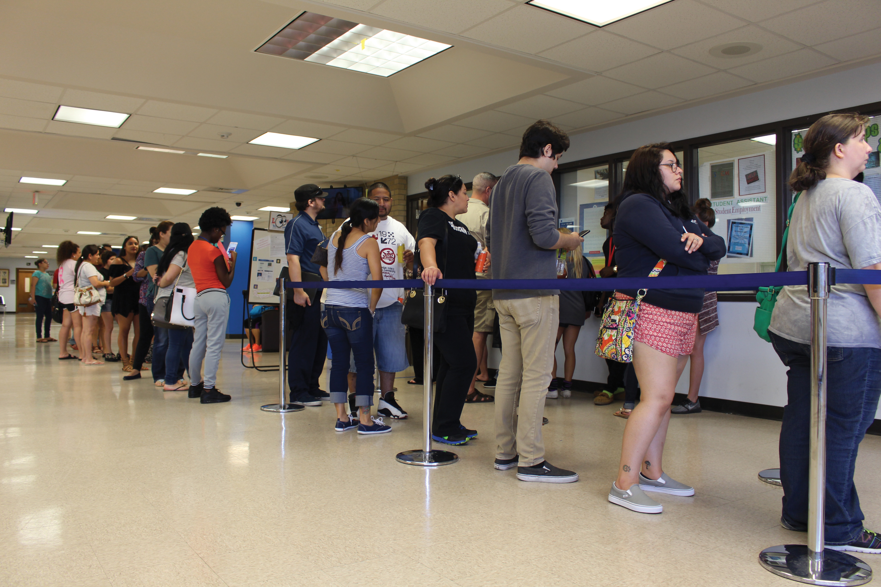
12,222 students the most since 2010, college officials say After more than a year since Harvey, Del Mar has finally stopped seeing the repercussion the disaster caused on enrollment numbers in fall 2017. At a Board of Regents meeting on Oct. 16, Rito Silva, chief academic adviser, explained to the regents that enrollment numbers incline at a steady pace within the past five years with hindrance in one area. “You see the small dip in 2017? Were calling that the Harvey effect,” Silva said. This year the enrollment number became the second highest that Del Mar has seen since 2010.…
Those heading out to the beach this Spring Break should stay mindful of a few important city laws and beach rules before soaking up some sun. Every spring, the Coastal Bend’s beaches attract thousands of residents and tourists, but according to law enforcement, if beach-goers want to stay safe, they must obey the rules. “We deal with a variety of mostly minor crimes including public intoxication, theft, fights and DWI,” said Port Aransas Chief of Police Scott Burroughs. “Almost every Spring Break arrest is either directly or indirectly related to the use or overuse of drugs or alcohol.” According to…

Corpus Christi’s hockey team, the IceRays, opened their season with two home games against the El Paso Rhinos. The teams met at the American Bank Center for the season-starting bout on Sept. 23 and 24. The first game started out shaky, with Rhinos forward Tory Lund scoring a goal by the end of the first period. Luckily, IceRays forwards Pierson Sobush and Mathieu Bourgault responded in kind with a goal apiece in the second period before the Rhinos tied it back up. The third period was quiet until two poorly timed penalties forced the Rays to field only three players…